A surveillance camera is only useful when its signal reaches the people who can interpret and act on it. Along a long pilgrimage route, aerial feeds, fixed cameras, observation posts, and ground teams must operate as one security system rather than isolated assets.
Vinkura built Project Hawk Eye to support that connected operating model. The platform helps turn distributed observations into a route-level picture for command teams.
- 416
- High-resolution CCTV cameras Anantnag Police reporting
- 5
- Drone detachments Anantnag Police reporting
- 28
- Elevated observation posts Anantnag Police reporting
- 22
- Specialist teams Anantnag Police reporting
Challenge
The Amarnath Yatra route combines difficult terrain, dense movement, sensitive points, and changing conditions. The deployed grid brought together 416 high-resolution cameras, 5 drone detachments, 28 elevated observation posts, and 22 specialist teams. Security teams needed to keep those assets aligned with what the control room could see.
Adding more feeds does not solve the problem by itself. Without a clear workflow, important observations can remain trapped in separate screens or reach field teams too slowly.
What we built
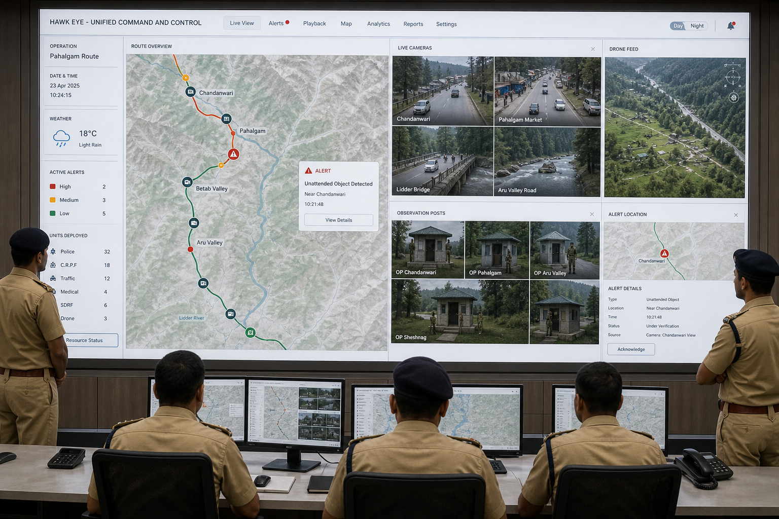
Project Hawk Eye brings the 416-camera network, aerial observation, and ground posts into a common framework. It helps command teams follow areas of interest, understand where an observation occurred, and connect that information to ground response.
We built a route-level command surface that keeps each alert connected to its originating feed, geography, and nearby response units. Technology supports route awareness; officers retain control of assessment, escalation, and response.
In the field
During the Yatra, the grid operated as one surveillance layer rather than a wall of separate screens. A surfaced event arrived with the source and location needed for command to verify it, route it, and coordinate the nearest ground team.
The field response then returned to the same record. Observation, decision, action, and review became one control-room-to-field loop.
Why it is different
Hawk Eye does not add another feed. It integrates fixed cameras, drone detachments, observation posts, route geography, alerts, and personnel into one operating picture. The original evidence remains inspectable, so an alert can be checked rather than blindly trusted.
The stack supports sovereign deployment and preserves a complete audit trail while keeping human authority at the point of action.
Impact
A connected view helps command teams move from observation to coordination with fewer information gaps. It also makes it easier to maintain attention across the route and communicate a shared understanding to teams on the ground.
Project Hawk Eye demonstrates how Vinkura approaches public-safety technology: integrate the tools already present, make the information operational, and design around the people responsible for the mission.
Further reading
News & media
Bring Vinkura into your operation
See the field-to-command loop in action
Talk with us about adapting this field-first, sovereign, and auditable approach to your teams, terrain, and institutional workflows.
Request an operational briefing →